Landscape Fires

Natural Hazards

Landscape Fires

 Prepared by the Global Fire Monitoring Center (GFMC) & the Editorial Board

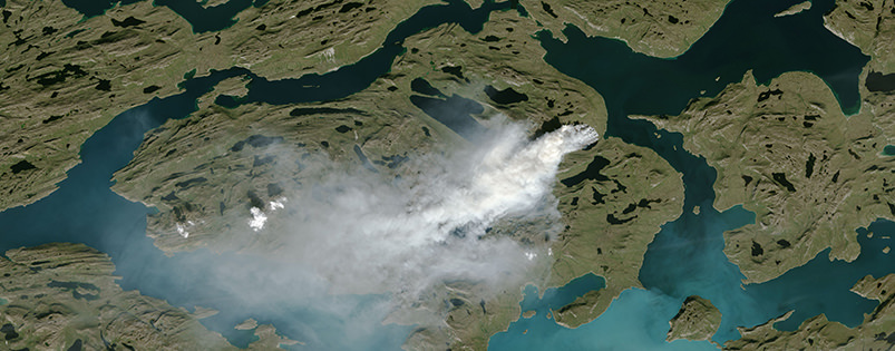
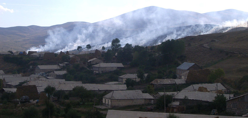
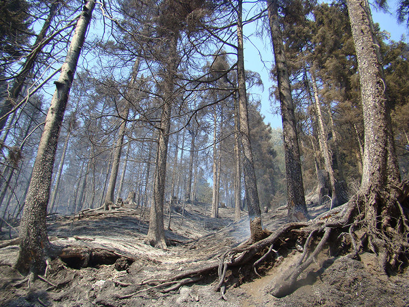
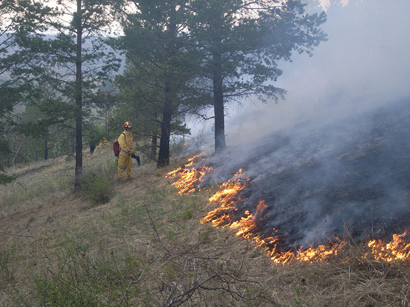
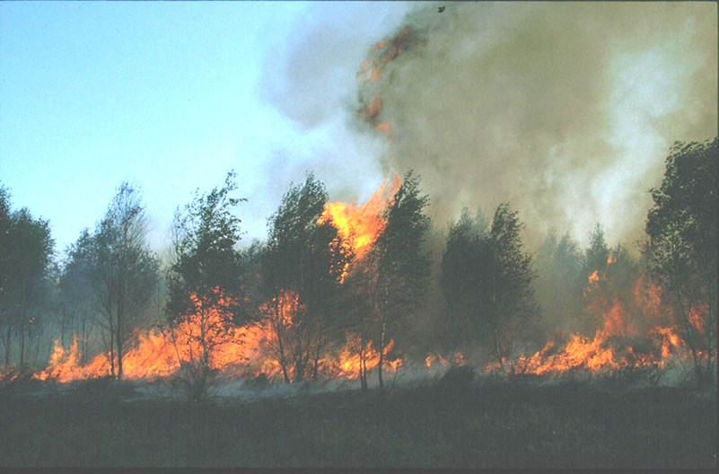
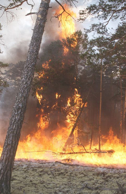
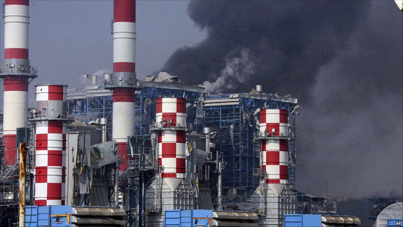
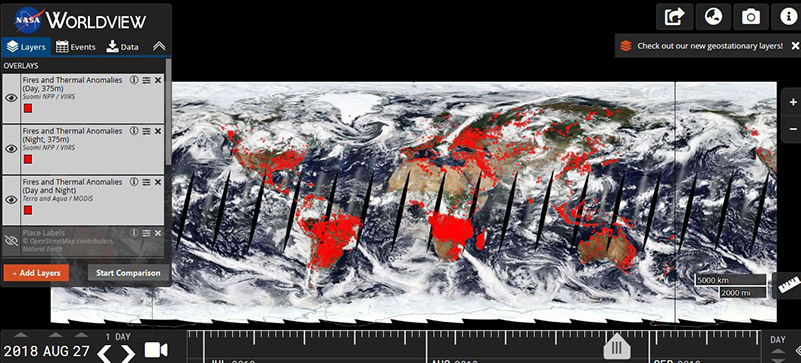
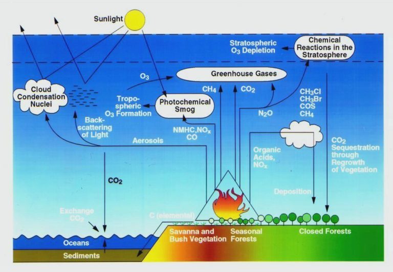
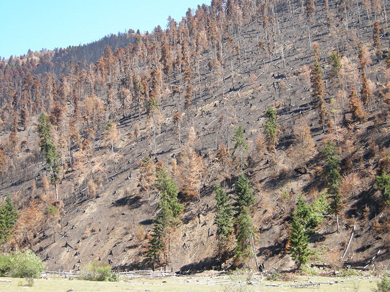
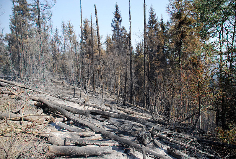
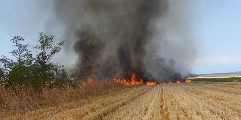
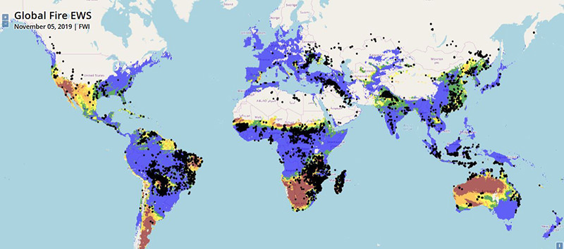
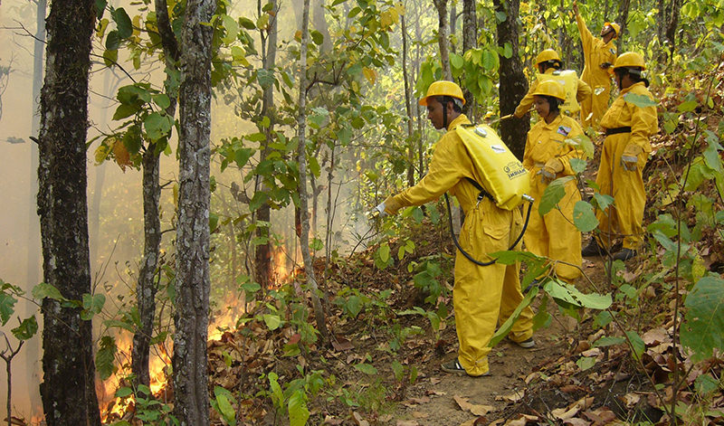
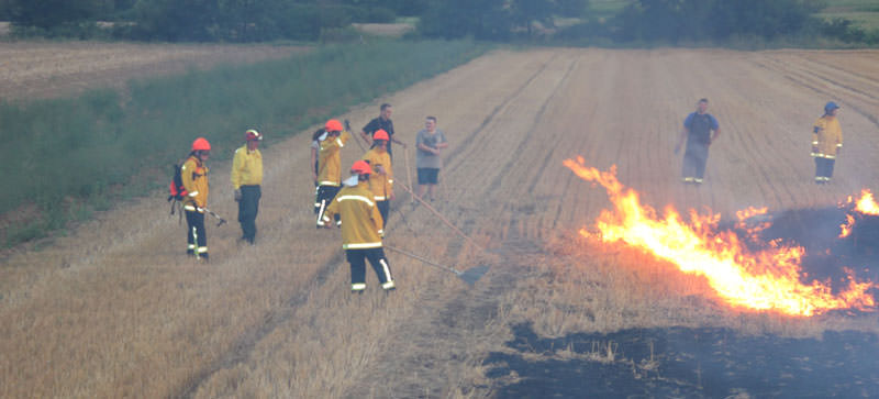
All over the world it is observed that fires are burning across the natural, cultural and industrial landscapes and the perimeters of villages, towns and cities, sometimes even entering densely built and populated urban areas. Therefore, the term “landscape fire” is used increasingly. Other names such as bushfire, forest fire, grass fire, peat fire and vegetation fire are also used to describe the same phenomenon depending on the type of vegetation burned. In most cases landscape fires are started in agricultural and pasture lands and then spreading to forests and other natural plant communities (bushlands, grasslands, savannas), and from there to residential areas and even cities.

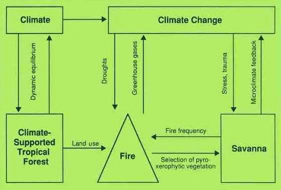
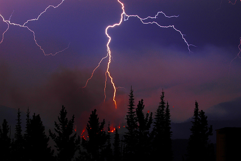
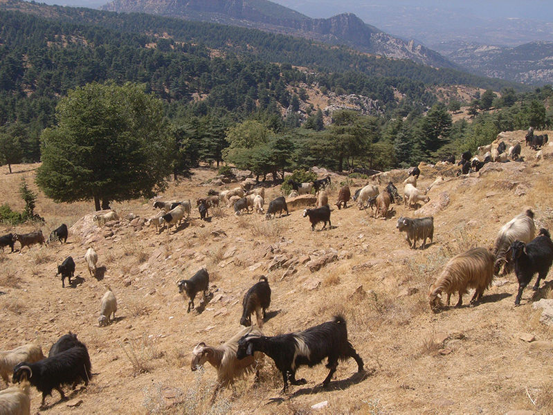
The term “wildfire” is used when fires are burning unwanted and unplanned. These fires are the main concern, because they usually have destructive effects on the environment and the security of society. During extreme drought, heat and strong winds a wildfire may reach a very large size and high speed. When a change of wind direction occurs the fire can change direction unexpectedly, and may easily jump over roads, rivers and other fire breaks. Landscape fires may affect residential and industrial areas (houses and other structures, peri-urban fringes, infrastructures including critical infrastructures) and remnants of human activities (waste deposits, contaminated lands), resulting in co-burning of hazardous / toxic substances. In many regions the occurrence and impacts of landscape fire are increasing due to land-use change. For instance, in many countries of Europe the rapidly evolving trend of urbanization of the young generation has resulted in abandonment of the rural space. Large areas of old cultural landscapes, which had been intensively cultivated by farmers and shepherds, are now overgrown by bush and tree cover. Consequently, the vegetation that is now growing on the lands, which formerly had been intensively harvested and grazed, are now creating the conditions for very intense and large fires. In addition, climate change all over the world is associated with the occurrence of longer-lasting and more severe droughts. The combination of increasing flammability of abandoned cultural landscapes and weather extremes are leading to very severe fires. The people living in these rural areas in farmsteads, villages or even in the perimeters of towns and cities, also visiting tourists, are becoming increasingly endangered by such intense and fast moving fires.

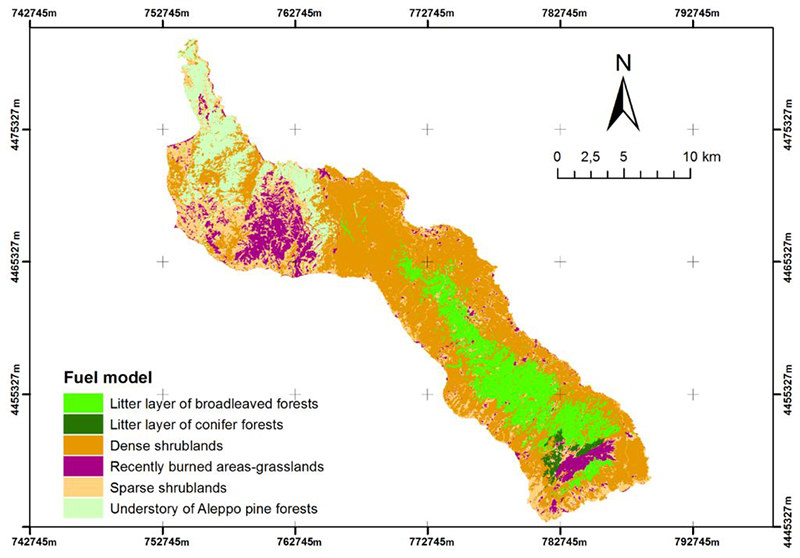
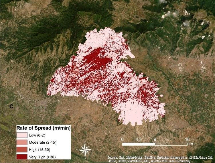
For more information on Landscape Fires, click HERE

Recent notable wildfire events

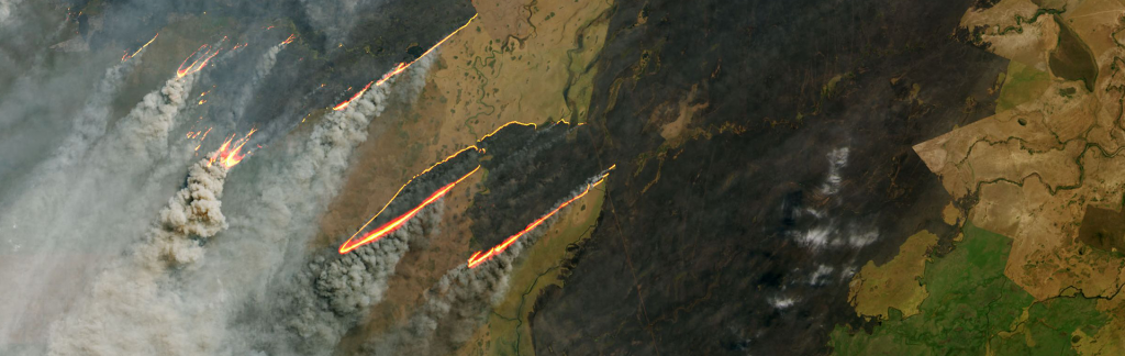
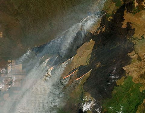
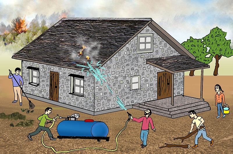
In the following a few examples are given on large and destructive wildfires in Australia, North and South America, Europe and in the subarctic zone. These examples from the last decade show that globally the natural, cultural and urban-industrial landscapes are increasingly endangered by fires. Many people are living in highly flammable landscapes and are often far away from the assistance of fire and rescue services or other land management authorities. This is why civil society must become aware of the landscape fire risks and be available to contribute to fire prevention and to protect their own homes, gardens and other property from fires by taking precautions. This website shall help to understand the occurrence, characteristics and impacts of landscape fires – a theme that needs to be addressed by the schools.

Australia 2009 and 2019
The so-called “Black Saturday Fires” were a series of fires that ignited or were burning across the Australian state of Victoria on and around Saturday, 7 February 2009, and were among Australia’s all-time worst bushfire disasters. The fires occurred during extreme fire weather conditions and resulted in Australia’s highest ever loss of life from a bushfire; there were 173 direct identified fatalities. The figure was later increased to 180 fatalities, after several people had succumbed to their injuries. Many were left homeless as a result. The extreme fires affecting Australia in 2019, notably New South Wales, resembled to 2009, but fortunately caused less fatalities than a decade ago.

United States 2017 and 2018
A series of 250 fires started burning across the state of California, United States in early October. Twenty-one became major fires that burned 99.148 ha. By 14 October 2017, the fires had burned more than 85.000 ha while forcing 90.000 people to evacuate from their homes. In total, the Northern California fires killed 44 people and hospitalized at least 192 others, making this one of the deadliest wildfire events in the United States during the past century.

The Camp Fire of 2018 was the deadliest and most destructive landscape fire in California’s history and also considered the deadliest fire in the United States. The fire started on 8 November 2018, caused at least 86 civilian fatalities, with one person still missing, and injured 12 civilians, two prison inmate firefighters, and three other firefighters. It covered an area of 62.053 ha, and destroyed 18.804 structures, with most of the damage occurring within the first four hours. Total damage was $US16.5 billion; one-quarter of the damage, $US4 billion, was not insured. With the arrival of the first winter rainstorm of the season, the fire reached 100 percent containment after seventeen days on 25 November 2018.

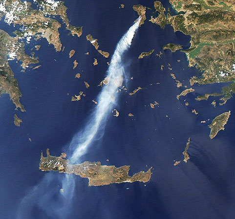
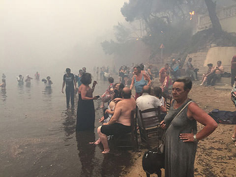
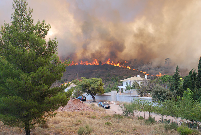
Greece 2007 and 2012
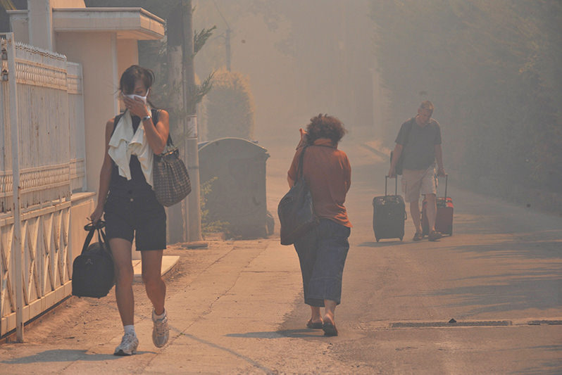
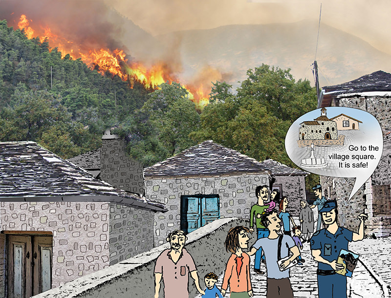
In 2007 Greece experienced the worst year on record for landscape fires. Arson and carelessness sparked more than 3.000 blazes. Extremely hot and dry weather conditions in Greece, combined with strong winds led to a disastrous upsurge of wildfires between 28 June and 3 September 2007. About 2.100 structures were destroyed, which scorched 100.000 ha and killed 84 people. More than 110 villages were destroyed leaving thousands of people homeless, while the flames burned dangerously close to historic, archeological and cultural sites (e.g., Olympia), as well as in protected areas (e.g., Mount Parnitha).

This fire burning on Chios on 22 August 2012 caused extremely high damage to the local population of the island, especially burning valuable orchards or individual mastic trees. The satellite image shows the smoke plume stretching from Chios to Crete. Source: NASA.

Russia 2010
Between June and August 2010 the densely populated region of Western Russia, with the capital region Moscow with more that 10 million inhabitants (totaling about 14 million people including the agglomerated suburbs), were affected by severe smoke pollution from fires that in total size were relatively small. However, the fires burned in peat bogs, which had been drained and colonized in the early and middle 20th Century for agriculture, establishment of settlements, and for energy production. The city of Elektrogorsk near Moscow was founded in 1912 with the establishment of the first large peat-fired power station to supply electricity for Moscow region. After the 1980s this type of electricity production came to a complete stop and many of these formerly very intensively utilized peatlands had been abandoned – but not restored to their original wetland character. In 2010 negligently caused fires entered deep turf layers where they smoldered for many weeks and even months – causing pollution that affected the health of people in Western Russia.
 
Portugal and Spain 2017
Four fires erupted across central Portugal in the afternoon of 17 June 2017, resulting in 66 deaths and 204 injured people. An intense heat wave preceded the fires, with many areas of Portugal seeing temperatures in excess of 40°C. During the night from 17 to 18 June, a total of 156 fires erupted across the country, particularly in mountainous areas 200 km north-northeast of Lisbon. Dry thunderstorms preceded the event and ignited numerous fires in the forests which are predominately composed of pine trees and the invasive species, eucalyptus, the latter having surpassed pine as the dominant tree in the country in the last ten years.
 
Between 13 and 18 October 2017 a series of more than 7.900 fires affecting the landscapes of Northern Portugal and Northwestern Spain. These fires were lit by arsonists and caused the lives of 49 people (45 in Portugal and four in Spain), while dozens more were injured.
 
Greece 2018
During the heat wave, which affected Europe in the summer of 2018 an extremely severe landscape fire erupted in the coastal area of Attica on 23 July 2018. The flames, which hit the urban perimeters of Athens, were so intense that they trapped and burned people inside their houses, cars, or a few meters away from the beach. Thousands of vehicles and houses were destroyed before the fire was brought under control hours late. 102 people killed by the fire. Over 700 residents had to be evacuated or rescued, mainly from the seaside settlements located north of the port town of Rafina. More than 4,000 residents were affected by the wildfires. A 65-year old man from the area had caused the fire through negligence, by burning wood in his garden. The fires were the second-deadliest in the 21st century, after the 2009 Black Saturday fires in Australia.

The Mati fire of 2018: Many of the fatalities were from burns and inhaling smoke and hot gasses, or from drowning while attempting to swim away from the coast to escape the unbearable conditions. Source: Xanthopoulos et al. (2019).

South America 2019
In South America – like in other regions of the tropics – fires are commonly used for cleaning agricultural fields and pastures, and for converting native vegetation to agricultural lands. In addition, uncontrolled wildfires are burning in savannas and open forests, which are highly flammable during the dry season. Although satellite data showed that there were less fires burning in South America in 2019 as compared to previous years, complaints by people living in rural Brazil and Bolivia as well as in cities like Sao Paulo about smoke pollution and the fear of environmental damages were reported globally by media reports and social media. These reports resulted in international response by politicians, e.g. by the governments of the so-called G7 Group (Group of the 7 economically most advanced industrialized nations – the U.S.A, United Kingdom, France, Germany, Italy, Canada and Japan) and by the public, calling for reducing the use of fire to convert the remaining and endangered tropical rainforests to agricultural lands.

Extended fires burning in grasslands, savannas and open forests were seen from space on 25 August 2019. Many of these fires covered all types of cultural and natural landscape elements, and the smoke pollution reached densely populated over long distances, such as megacities like Sao Paulo. Source: NASA.

Arctic Circle 2017 and 2019
In the higher latitudes of the Northern Hemisphere fires have occurred rather seldom in the last decades and centuries. The prevailing wet and cold environmental condition, in some regions with year-round snow and ice cover, did not create conditions for the regular occurrence of fires. Only in extraordinary dry years these ecosystems desiccated sufficiently allowing fires to burn. Progressive warming of the Northern latitudes as a consequence of climate change are now creating conditions for higher fire occurrence, especially in the treeless shrub ecosystems of the Subarctic tundra. For instance, fires in Siberia (Central Asia) are becoming more common in the Northern latitudes. For the first time wildfires were observed in Greenland in 2017 and 2019.

This Operational Land Imager (OLI) on the satellite “Landsat 8” captured a landscape fire in Western Greenland on 3 August 2017. Most of Greenland is covered by ice, but dwarf willows, shrubs, grasses, mosses, and other vegetation occur in some coastal areas and are becoming increasingly subjected to fire. Source: NASA.

“Landscape fire” is a term applied to any fire burning in natural and cultural landscapes, e.g. natural and planted forest, shrub, grass, pastures, agricultural lands and peri-urban areas. The number of fires and the area burned is increasing in some regions because traditional land cultivation is abandoned and people are leaving the rural villages and move to urban centers. As a consequence, an accumulation of fuels (= all combustible organic material in forests and other lands in the form of fallen leaves, needles and branches etc.) is observed because people are less and less utilizing the small woody materials for cooking and heating. On abandoned fields and pastures bush and tress are invading and making these formerly cultivated land-use systems more flammable. At the same time urban inhabitants are building weekend or summer houses in the natural vegetation, and these are highly endangered by fire. During the recent years it has been observed that an increase of extremely dry and hot weather periods around the world have created conditions for large and almost uncontrollable wildfires.

Wildfire burning in a landscape with intermixed forests, bush, grassland and interspersed houses. Source: GFMC.

Three types of landscape fires burn in wildland areas when conditions of fuel and weather permit ignition and sustained combustion: ground fires, surface fires and crown fires.
 
Ground fires burn in organic material of the soil layer (e.g. a peat fire) and usually do not produce
a visible flame. They can penetrate in very deep organic deposits and smolder several decimeters under the surface.
Surface Fires occur on the surface of the forests, in heathlands and grasslands with flame length up to one meter or slightly more. That type of landscape fire burns loose debris on the surface, which includes dead branches, leaves, needles and low vegetation.
Crown fires are the most dangerous fires affecting forest stands and can spread very fast. Crown fires may burn individual tree crowns or the whole forest canopy.

Effects of a ground fire: The burning of the organic layer (raw humus) in this forest results to high mortality of trees and subsequent erosion. Source: GFMC.
A surface fire burning downhill is spreading slowly and with low flame lengths. Source: GFMC.
A grass fire spreading uphill with high speed and long and dangerous flames. Source: GFMC.

 (left). 

Surface fire developing in a crown fire in a young pine-birch forest. Source: GFMC.
Surface fire developing in a mature pine forest. Source: GFMC.

Every year, landscape fires cause damages to ecosystems and also threaten residential areas like farms, villages and the perimeters towns and cities. There are many factors that contribute to an increased fire risk, such as high temperatures and prolonged drought periods, the strong winds, the configuration of the fuels on the ground and the extremely flammable vegetation.

Wildfire threatening a residential area. Source: N. Giakoumidis.
On 11 July 2011 a grass fire ignited an ammunition depot in a naval base of Cyprus. Source: Cyprus Navy.
The explosion of the depot also took out the island’s main power station, located in the area of Vassiliko on the outskirts of Limassol, disrupting power supplies. This example shows that wildfires are spreading over natural, cultural and industrial landscape elements. Source: Cyprus Navy.

The “Fire Triangle” is a simple way of understanding how landscape fires occur. Each side of the triangle represents one of the three components needed to have a fire – oxygen, heat, and fuel. When there is not enough heat generated to sustain the process, when the fuel is exhausted, removed, or isolated, or when oxygen supply is limited, then a side of the triangle is broken and the fire will extinguish.

The “Fire Triangle”

Heat

A heat source is required for the initial ignition of fire, and heat is also needed to maintain the fire and permit it to spread. Heat allows fire to spread by removing the moisture from nearby fuel, warming the surrounding air, and preheating the fuels in its path, enabling it to spread with greater ease.

Fuel

Fuel is any kind of combustible material. Its readiness for ignition and spread is determined by its moisture content (how wet the fuel is), size and shape, quantity, and the arrangement in which it is distributed within an ecosystem or over the landscape.

Oxygen

Air contains about 21% oxygen, and landscape fires require at least 16% oxygen content to burn. Burning fuels react with oxygen from the surrounding air and release heat and combustion products, e.g. smoke (gas and fine particle emissions), which is dangerous to human health, and glowing embers, which may start new fires).

The wildfires described above in “Recent notable landscape fire events” are examples of fire burning in North and South America, Europe and the Northern Latitudes, which have caused significant damages to the environment and society. However, there are vast natural landscapes in of tropical and subtropical Africa, Asia, Australia and the Americas where fires are a common phenomenon and where vegetation is adapted or tolerant to regular fire occurrence. Approximately 80% of global fires occur in grasslands and savannas, primarily in Africa and Australia, but also in South Asia and South America; the remaining 20% occur in the world’s forests.

Global fire activity map: The Worldview Service of NASA provides a real-time global overview of actively burning landscape fires (all fire types). Please click on the map for watching and downloading the distribution of fires all over the world. Source: NASA

Landscape fires of both natural and anthropogenic origin have known biotic and abiotic effects on ecosystem properties and the environment. The biotic effects of fire include changes in vegetation and subsequent impacts on wildlife. Abiotic effects include changes in soil properties, nutrient cycling and air quality. The health and security of human populations are also impacted.

Effects of fire on plants: The primary effect of fire on plants is death or damage to living cells. Plant cell death, regardless of species, occurs at 60°C. At somewhat lower temperatures, more time is required to kill plant tissues. Fire can have also positive effects on plants. Some plants rely on fire to release their seeds, eliminate competition or supply a layer of nutrient-rich ash. For example, cones of jack pine tree can hang for years without opening and only the fire melts the resin, allowing the cones to open up and release the seeds.

Effects of fire on wildlife: Fire can have both positive and negative effects on wildlife. The specific effects depend upon the frequency, intensity, severity, and season of burning, as well as the habitat requirements of wildlife. Fire effects on wildlife are mainly indirect through changes in food and cover. Fires can create open space and stimulate the growth palatable grass and shoots, thereby improving conditions for deer and other wildlife.

Effects of fire on soil: Fire affects the chemical, biological, and physical properties of soil. Specific effects of fire on soil may vary greatly depending on the fire intensity, ambient temperature, vegetation type, soil type, and soil moisture. These factors can produce either positive or negative effects. The specific effects of fire on soil are largely determined by fire intensity. Low-intensity fires have little adverse effect on soil properties. In fact, they may even improve the availability of nutrients contained in the ash. Severe fires may potentially alter soil physical properties by consuming soil organic matter. This can result in soil erosion, surface run-off and flood generation.

Effects of fire smoke on air quality and human health: The smoke of landscape fires contains particulate matter and gases that can have negative short and long-term health effects, like carbon monoxide, carbon dioxide, sulfur dioxide, nitrogen dioxide, and ozone. High smoke concentrations can cause a serious health risk for people with respiratory illnesses – especially children, the elderly and those infected by a virus (e.g., COVID-19 pandemic). Firefighters exposed to high smoke concentrations, often suffer eye and respiratory system irritation. Continued exposure to high concentrations of carbon monoxide in the combustion zone can result in impaired alertness and judgment. Fine carbon particles, inhaled by people and deposited in their lungs, may cause cancer.

People wearing masks to filter out smoke from landscape fires surrounding a residential area, Greece, summer 2007. Source: N. Giakoumidis.

Effects of fire emissions on the atmosphere and climate: Since prehistoric times, natural landscape fires have affected ecosystems in all continents. More than a million years ago, early humans began to use fire for hunting, pastoralism and agriculture. Emissions from these fires have always been an essential part of so-called “biogeochemical cycles” and have influenced the chemical composition of the world’s atmosphere. For instance, carbon dioxide (CO2) released into the atmosphere by landscape fires is subsequently taken up by post-fire vegetation regrowth. The process of “recycling” of CO2 from the atmosphere by vegetation regrowth is complete, once the ecosystem has fully recovered – in this case, there is no increase of the “greenhouse effect” by CO2 from landscape fires. However, in some ecosystems the fire effects are different and result in a net storage of CO2 in the atmosphere and thus contribute to the modern increase of the natural Greenhouse Effect. Two examples are given. First, the use of fire in the conversion of natural ecosystems to agricultural and pasture lands in the tropics. As a consequence, carbon-rich rainforests or peatlands are replaced by carbon-poor agricultural fields or pastures, which do not take-up the same amount of carbon. Secondly, the fires in tundra and peat ecosystems in the Northern latitudes, which are becoming desiccated as a consequence of climate change. These fires have detrimental effects on ecosystems and climate: Given the predicted future climate scenarios, it will be highly unlikely that these ecosystems will recover. Thus, the emitted carbon remains in the atmosphere.

Emissions from landscape fires are influencing the composition to the atmosphere. Some trace gases are contributing to the Greenhouse Effect. In contrary, aerosols reflect incoming solar energy and thus have a cooling effect. Source: GFMC.
Visualization of the consequences of degradation of tropical rain forests by fire and climate change: Deforestation fires emit greenhouse gases – the increased Greenhouse Effect results in more severe droughts; as a consequence, degraded forests are becoming more flammable. Source: GFMC.

The effects of landscape fires are influenced by a combination of natural factors such as topography, the amount and distribution of fuels, and by weather. Other than reducing human infractions, only fuels may be altered to affect future fire risk and behavior. Landscape fire prevention programs around the world may employ techniques such as prescribed or controlled burns which are set by experts under less dangerous weather conditions in order to obtain desired effects, e.g., the reduction of fuels or favoring biodiversity by creating open spaces.
 
The effective rehabilitation of burned areas is important to avoid secondary losses or disasters, such as erosion, landslides or mudslides, or floods. This can be achieved by applying emergency treatments on natural lands to minimize threats to life or property resulting from the effects of a fire or to stabilize and prevent unacceptable degradation to natural and cultural resources. There are a variety of emergency stabilization techniques: Reseeding of ground cover with quick-growing or native species, mulching with straw or chipped wood, construction of straw, rock or log dams in small tributaries and placement of logs to catch sediment on hill slopes are the primary stabilization techniques used.
 
Landscape fires also affect air quality. Smoke contains a number of pollutants that can cause serious health problems. Exposure and vulnerability of humans to landscape fire emissions can be assessed by air quality monitoring and smoke dispersion models.

Severe erosion after a wildfire in the mountains of Georgia, South Caucasus. Source: GFMC.
Erosion control using burnt trees. Source: GFMC.

The causes of landscape fires are divided into “natural” and “human-caused”:

  • Natural: The most common cause is lightning. During thunderstorms (thunderstorm that occur without rainfall, also called dry thunderstorms) cloud-to-ground lightning strikes find deal conditions to ignite dry vegetation cover and expand to large wildfires. In some regions volcanic activities can result in wildfires.
  • Arson: Fires caused by deliberate human action, for many reasons.
  • Negligence: Fires caused by unintentional human action such as disposal of burning cigarettes, burning of waste, outdoor work (by machinery), hikers, hunters, campfires, children playing with fire, military shooting exercises, sparks from trains, and various other causes such as traffic and industrial accidents.
  • Agricultural and pasture burning: Burning of agricultural crop residues on fields and fires set by shepherds to clean pastures from dry vegetation and bush encroachment are the most important causes of uncontrolled wildfires. Very often these fires are not attended and spread to forests, protected areas or settlements.

 
In many countries the causes of fires cannot be identified easily. Thus, the amount of unknown fire origins is often very high.

A fire ignited by lightning. Source: NASA.
Burning of fields can cause uncontrolled landscape fires which may spread to villages and forests. Source: GFMC.

Landscape fire occurrence can be predicted by fire danger rating systems. Fire danger rating systems have been developed in many fire-prone regions around the world to assist authorities in a variety of fire management activities such as assessing the potential for fires and issuing fire warning. Traditionally, these systems combine different environmental variables affecting landscape fire behavior, such as weather data (e.g., temperature, relative humidity, wind speed and direction), terrain properties (e.g., slope and aspects) and fuel characteristics (e.g., type and load), into numerical fire danger indices. Such indices are designed to provide a quantifiable measure of the potential for landscape fires to ignite, spread and be suppressed.

Global fire danger map with location of active landscape fires over the last 24 hours (black dots). Source: GFMC.
Regional European fire danger map. Source: JRC / EFFIS.
Public information by forest and land management on the local fire danger. In this case of Syria the green color indicates low fire danger, yellow medium (or moderate) and red = high. Source: GFMC.

Fire prevention refers to the preemptive methods of reducing the risk of starting unwanted landscape fires as well as lessening its severity and spread. Prevention policies must consider the role that the majority of landscape fires are caused by humans. It is estimated that around 95% of wildfires worldwide are caused by humans.
 
Landscape fires can be prevented by informing, educating and alerting the general public by mass media (radio, television, newspapers, web sites, social media and various other publications designed to reach general public) about the risk of fire and its consequences. The use of mass media is one of the best means of public education in the prevention of landscape fires. Furthermore, fire prevention training in schools and colleges, targeting young people, is an important part of any prevention effort.
 
The spread of landscape fires can be prevented by constructing or using existing barriers, such as firebreaks and fuelbreaks. The usual firebreak is a strip of a width of one to two meters that has been cleared of trees, scrub and the grass layer by using a plough “mineralized” strip. Natural fuelbreaks may be natural barriers, such as a road or a water stream, or especially constructed barriers.
 
Under high wind conditions the fire may cross the firebreaks if no firefighters are on standby. This is why natural fuelbreaks are used or even widened, or strategic fuelbreaks constructed. These are generally wide (20 – 300 meters) strips of land on which either less flammable native vegetation is maintained and integrated into fire management planning, or vegetation has been permanently modified so that fires burning into them can be more readily controlled. In some countries fuelbreaks are integrated elements of agro-silvopastoral systems in which the vegetative cover is intensively treated by crop cultivation or grazing. Fuelbreaks have the advantages of preventing erosion, offering a safe place for firefighters to work, low maintenance, and a pleasing appearance.

Fire approaching a firebreak constructed by an agricultural plow. The firebreak can contain the spread of a fire if properly guarded by firefighters. In this example they do not fight the fire on the left side, but extinguish any fire jumping over the firebreak. Source: GFMC.
 If carefully controlled, grazing by animals contributes to create fire safety belts around vulnerable forests or settlements, as shown in this example from Lebanon. As a consequence of intensive grazing the firefighters can enter these zones more easily and control a wildfire, which would burn less intense due to the reduced amount of combustible grass and bush vegetation. Source: GFMC.

Landscape fires consequences can be mitigated by systematic application of methods and technologies, based on the recommendations of practice-oriented fire research:

  • Fire research: Although a lot is known about the causes, characters and consequences of landscape fires there is a need of continuous research of socio-economic and environmental conditions that are changing in many regions and influence the occurrence and impacts of landscape fires.
  • Institutional co-operation: National agencies such as forest services, fire services, agricultural services or health services must work together and develop coordinated fire management plans.
  • Involvement of all stakeholders in policy development: National fire management policies must be developed by considering the needs and participation of civil society. All ministries concerned should collaborate.
  • Communitybased fire management: Rural villages, farmers and land owners should participate in the efforts of fire prevention, early detection of landscape fires and even assisting in rapid suppression of a fire at its very early stage. Community forestry approaches are successful because people who own forests or are allowed to utilize timber and other forest products have a high interest to protect “their” forests because the forests are generating income.
  • Effective stabilization and rehabilitation of burned areas: The swift re-vegetation of burned areas is important to avoid secondary losses or disasters, such as erosion, landslides or mudslides, or floods.
  • Transboundary or regional agreements for collaboration in fire management: Neighboring countries should share common research and training of professionals. This will economize investments and assist preparing for mutual assistance during landscape fire emergencies.
  • A global fire information system: Such system is needed to provide immediate access to real-time data and information on current fires and archived information.
Community-based fire management: Villagers in Nepal defend their forests and fields from an approaching fire. Please note the fire-safe clothing. Source: GFMC.
Training of local volunteer fire fighters: Fire suppression exercise on a harvested agricultural field – a safe way to demonstrate the use of hand tools and backpack pumps. Source: GFMC.

Preparing for a landscape fire

If you live in an area prone to landscape fires, here are some tips on how to prepare yourself and your property for an emergency:
 

  • Consult with your local fire department about making your home fire-resistant.
  • Check for, and remove, fire hazards in and around your home, such as dried out branches, leaves and debris.
  • Keep a good sprinkler in an accessible location.
  • Learn fire safety techniques and teach them to members of your family.
  • Have fire drills with your family on a regular basis.
  • Make sure every floor and all sleeping areas have smoke detectors.
Remove living and dead vegetation and firewood storage nearby houses and outbuildings. Source: Guidelines on Defense of Villages, Farms and Other Rural Assets against Wildfires (GFMC).

During a landscape fire

  • Monitor local radio stations.
  • Be prepared to evacuate at any time.
  • Remove all patio furniture, umbrellas, tarps and other combustible material from your yard.
  • Close all doors in your home, and shut off gas valves and pilot lights.
  • Remove flammable drapes, curtains, awnings or other window coverings.
  • Keep lights on to aid visibility in case smoke fills the house.
  • If sufficient water is available, turn sprinklers on to wet the roof and any water-proof valuables.
Small flying embers from bush and forest fires are an important cause of house fires. They will not ignite your garden and house if the flammable materials are removed before the fire. Burning embers can be extinguished easily when landing on your garden or house roof. Source: Guidelines on Defense of Villages, Farms and Other Rural Assets against Wildfires (GFMC).

People living in farmsteads, weekend houses and villages should always be prepared for a wildfire. Throughout the year the fire meteorological fire danger is changing with the seasons. During the hot and dry summers fire danger forecasts broadcasted by TV, radio and social media should be observed. Everyone in the neighborhood should be prepared to cooperate for assisting each other and follow evacuation orders if necessary. Source: Guidelines on Defense of Villages, Farms and Other Rural Assets against Wildfires (GFMC).

Mapping the timing and the extent of landscape fires is important as fire is a prominent change agent affecting natural ecosystems, the cycling of carbon and nutrients and is a globally-significant cause of greenhouse gas emission. Data from weather satellites and Earth observation satellites can be combined to produce daily maps. These enable fire managers and firefighters to concentrate on the areas at highest risk.
 
The maps are either produced internally in public authorities’ offices, research institutions, and publicly accessible on the internet.
 

  • Mapping can be defined as active when near real-time detection and characterization of landscape fire conditions are provided.
  • Other type of vegetation mapping is the burned area maps, where detailed and current information concerning the location and extent of the burned areas and the level of fire damage is important to assess economic losses and ecological effects, to monitor land use and land cover changes, and to model the atmospheric and climatic impacts of biomass burning.
  • Fire behavior maps are also used for potential fire behavior characteristics (spread rate, flame length, fireline intensity, etc.) over an entire landscape in order to help with firefighting.
  • Furthermore, maps are used to image the areas that are burning and pick out major hot spots within the burnt area. They can also detect greenhouse gases, smoke plumes produced by the fires and for monitoring the post fire effects (soil erosion, flood potential and regeneration process).
Fuel type map which depicts the spatial distribution of various fuel (vegetation) types across the landscape. Source: Mallinis et al. (2016).
Fire behavior map which shows the expected fire rate of spread in a specific area under predefined weather conditions. Source: Mitsopoulos et al. (2017).

Selected references

Ahern, F.J., Goldammer, J.G., and Justice, C.O. (eds.). 2001. Global and regional vegetation fire monitoring from space: Planning a coordinated international effort. The Hague, The Netherlands: SPB Academic Publishing.

Byram, G.M. 1959. Combustion of forest fuels. In: Davis K.P. (ed.), Forest fire: Control and use. New York, McGraw Hill Book Co, pp. 61-89.

DeBano, L.F., D.G. Neary, and Ffolliott, P.F. 1998. Fire’s effects on ecosystems. New York: John Wiley & Sons. 333 p.

Global Fire Monitoring Center (GFMC). 2013. Vegetation fires and global change: Challenges for concerted international action. A white paper directed to the United Nations and international organizations. Edited by Johann G. Goldammer. Kessel Publishing House, Germany. 399 p.

Global Fire Monitoring Center (GFMC) 2019. Report of the Independent Committee tasked to Analyze the Underlying Causes and Explore the Perspectives for the Future Management of Landscape Fires in Greece.  Report to the Government of Greece, based on the Ministerial Decision Υ60 (Gov. Gaz. 3937/Β/2018).

Mallinis, G., Mitsopoulos, I., Beltran, E., and Goldammer, J.G. 2016. Assessing Wildfire Risk in Cultural Heritage Properties Using High Spatial and Temporal Resolution Satellite Imagery and Spatially Explicit Fire Simulations: The Case of Holy Mount Athos, Greece. Forests 7(2): 46.DOI: 10.3390/f7020046

Mitsopoulos, I., Mallinis, G., Zibtsev, S., Yavuz, M., Saglam, B., Kucuk, O., Bogomolov, V., Borsuk A., and Zaimes, G. 2017. An integrated approach for mapping fire suppression difficulty in three different ecosystems of Eastern Europe. Journal of Spatial Science 62 (1): 139-155, DOI: 10.1080/14498596.2016.1169952

Moreno, J.M., and Oechel, W.C. 1994. The role of fire in Mediterranean type ecosystems. Ecological Studies 107, Springer-Verlag, New York. 201p.

Pyne, S.J., Andrews, P.L. and Laven, R.D. 1996. Introduction to wildland fire science. 2nd edition. John Wiley & Sons, New York. pp. 769.

Schroeder, M.J., and Buck, C.C. 1970. Fire weather. USDA, Forest Service, Agriculture Handbook 360. 229 p.

Stocks B.J., Lawson, B.D., Alexander M.E., Van Wagner, C.E., McAlpine, R.S., Lynham, T.J., and Dube, D.E. 1989. The Canadian Forest Fire Danger Rating System. Forest Chronicle 65: 450-457.

Xanthopoulos, G., Dimitrakopoulos, A., Eftychidis, G., Mallinis, G., Mitsopoulos, I and Goldammer, J.G. 2019. A year after Greece’s wildfire disaster. J. Crisis Response 14 (4): 26-30.

Web Resources